Google Maps Feature, Transit Navigation (Beta), Lets You Know When To Get Off the Bus/Train (as long as you are not underground)

July 6, 2011 at 7:10 pm

(Source: Youtube via Jalopnik)

Google Maps 5.7  is now available with a deeper public transit navigation for users in nearly 400 cities around the globe. As shown in the above video, using your location along the route, the Transit Navigation feature on Google Maps will alert you when its time to get off at your destination or to make a transfer. Transit Navigation (Beta) requires a phone with Android 2.1+ (too bad, Apple users are missing out here) and the latest update of Google Maps for mobile. Oh, the only caveat is that the system works only for above-ground transit systems where the GPS signals can be reached.  And for those with plenty of time to spare, here is a hands-on review of the new feature, courtesy of Engadget. I can already surmise this is a god’s gift (or Google’s) for the international travelers.

Game Changer! Google Unveils Free Map Navigation Service; Throws a Dagger in the Heart of SatNav Market

October 29, 2009 at 7:05 pm

(Source: Mashable & Guardian, UK)

Could the satnav (Satellite Navigation, for those not in know) – the saviour of many a long car journey – about to be consigned to the dustbin of history, alongside Betamax tapes and HD-DVDs?

After enjoying years of seemingly unassailable popularity with gadget fans and travelling salesmen, those little gadgets hanging on your vehicle’s Dashboards could become redundant excesses because of the threat from a new breed of mobile phones that feature the sort of mapping technology that wouldn’t look out of place on the most expensive TomTom. GoogleGoogle just released a beta version of Google Maps Navigation for AndroidAndroid 2.0. operating system, a new tool, based on Google’s existing road maps platform, that will provide turn-by-turn directions, automatic re-routing and 3D street-level views. In short, pretty much everything your satnav can do, but without the need to worry about an extra bit of kit when you load up the car.

The share prices of leading satnav manufacturers, such as TomTom and Garmin, nosedived on the news. Garmin’s share price dipped by 18 per cent, TomTom’s by 13 per cent – a huge hit, and a clear sign that the market is taking the threat posed by Google very seriously indeed.

Here’s a quick overview of the features:

  • Search in plain English – quickly search and navigate to places, businesses, landmarks
  • Search by voice
  • View of live traffic data over the Internet.
  • Search along route – find locations near your current path
  • Satellite view – you can view the same satellite imagery you’ve seen Google MapsGoogle Maps, on your phone
  • Street View – check out what the exact surroundings of a location look like
  • Car dock mode – when you place certain devices in a car dock, a special mode activates that enables easier operation

GPS turn-by-turn navigation has historically always been something you had to pay for. Creating and maintaining a map of the entire world, together with points of interests and traffic info, plus developing the algorithms that make sure you don’t take a wrong turn, costs millions of dollars. But Google is now offering it for free. The result was devastating for shares of GPS navigation companies: Garmin’s shares fell by 16.4%; TomTom’s by 20.8%. We’re talking billions of dollars of market capitalization, gone in one day, just because Google presented another free product (they release new products on a monthly, if not weekly basis).

It’s certainly an ambitious idea – the Google Maps Navigation tool will draw upon several areas of Google expertise, such as search and location-based services, to deliver clear views of the best routes, complete with finest restaurants, cosiest hotels and cheapest petrol stations along the way.

Live traffic information will be pushed directly to your Android phone, helping you to avoid jams. And users will be able to wave goodbye to the annual hassle of the satnav map update – the latest, most accurate maps will be sent to Android phones by Google over the mobile phone network, which means there won’t be any of the nasty surprises so common with stand-alone sat-navs, such as being directed down a newly designated one-wastreet.

Street View – real, street-level photography that shows the roads, buildings and landmarks around you – will also be an excellent feature, enabling you to quickly and easily pinpoint your location in an unfamiliar neighbourhood, and visualise the remainder of your route.

Guardian says “Converged devices, though, are undoubtedly the future, and the all-singing, all-dancing phones we’re starting to see growing in popularity are set to be the ultimate multitasking gadget, handling everything from social-networking to email, playing music or taking photos, and guiding us around town, be it on foot or in the car.

Google Maps Navigation may very well prove to be a satnav killer in time, but don’t throw out your TomTom just yet.

Click here or here to read the entire article.

Google maps makes inroads into live traffic data market; Adds live traffic conditions data for arterial roads

August 25, 2009 at 5:27 pm

(Sources contributing to this hybrid report:  CNET; Ars Technica; LifeHacker; eweek-Google Watch)

In the movie business, the  blockbusters are often reserved for the summer months.  Just like the movie-makers, the Googlers are making it a habit to unveil some of their coolest products over the summer months and this year is no exception (as if they are not doing anything cool during the rest of the year).

The Google Maps team has been on quite the tear this summer, enriching its platform and beefing up location-based services, such as Google Latitude. In just the past two months, the search and Web services giant has offered multiple searches for one search destination session, shown users how to get Google Maps on Web sites, and offered a Street View tutorial.  Now they are at it again – this time with another awesome feature: live traffic updates for arterial roads in addition to the data it already offers up for major highways.

Google Maps is adding traffic data for side streets starting today, which combined with a the data it already offers up for major highways makes it a “must-have” tool for all roadwarriors. Major “arterial” roads, such as state highways or prominent boulevards in cities, will now have their own color-coded traffic information in Google Maps, giving drivers the option of selecting an alternate route based on current traffic conditions.

Image Courtesy: LifeHacker

So how is Google expanding its traffic reports to side streets? If you’re using Google Maps on your smartphone (with the notable exception of the iPhone, which doesn’t support the feature, according to Google) you’re automatically sending speed data back to Google wherever you go.

The trigger is the “My Location” button in Google Maps, which automatically signs you up for the traffic crowdsourcing program when that button is pressed. In addition, Palm Pre and MyTouch 3G users are automatically enrolled in the traffic crowdsourcing program.

You can opt out of the program, but at the expense of the My Location feature. Hit the “My Location” button again to figure out where you are in an unfamiliar city, and you’re automatically re-enrolled in the program.

Traffic data has been available on major highways for years through Google Maps, but that data is collected from road sensors and private car fleets and is also available to dozens of third-party traffic providers. The number of people using GPS-enabled smartphones with Google Maps installed has dramatically increased since 2007, and many of them may not know that by using the My Location feature, they’re also participating in a traffic-related survey.

MSFT HQ Map.png

Image Courtesy: Google Watch (Eweek) - Traffic conditions snapshot around Microsoft headquarters, Seattle

This is a fantastic feature (assuming you don’t mind the anonymous usage statistics going to Google), and one that’s actually available in some GPS devices already. The drawback on some devices—the iPhone, for example—is that you’d need to use Google Maps in place of another GPS application, and since the iPhone now features turn-by-turn GPS navigation applications, it’s a bit of a sacrifice. Still, if Google were to go the extra mile and turn Google Maps into a turn-by-turn GPS app (something that seems well within reason, considering how much map data they’ve already got), then they’d really be on to something that a lot of us would potentially use.

Not only can you get live traffic updates, Google Maps lets you select options for viewing the average traffic patterns on a specific day and time. Say you’re taking a road trip and you’re leaving on Thursday at 5pm—you can now look up the traffic in advance for planning purposes (see image below to the right).

gmaps_trafficchoices_ars.png

Image Courtesy: Ars Technica

In addition to the arterial road information, Google has also begun using crowdsourced data for traffic information. If you use Google Maps for mobile with GPS enabled, you can choose to allow Google Maps to send regular updates (anonymously, of course) about where you are and how fast you’re moving.

“When we combine your speed with the speed of other phones on the road, across thousands of phones moving around a city at any given time, we can get a pretty good picture of live traffic conditions,” wrote Google. “We continuously combine this data and send it back to you for free in the Google Maps traffic layers.”

Google assures users that they only use anonymous speed and location information to calculate traffic conditions, and only do so when the user has opted to enable location services on his or her phone.

The problem with the location-based services is that it affects a skittishness in people. Concepts like location-based services that send “bits of data back to Google” tend to make people nervous. Electronic Frontier Foundation has a great report on the intersection of location services and privacy.

“We understand that many people would be concerned about telling the world how fast their car was moving if they also had to tell the world where they were going, so we built privacy protections in from the start,” wrote Dave Barth, product manager for Google Maps. “We only use anonymous speed and location information to calculate traffic conditions, and only do so when you have chosen to enable location services on your phone.”

Click here to read the entire article.

Tech savvy teenager takes Lexington transit into (un)chartered territory

March 30, 2009 at 6:19 pm
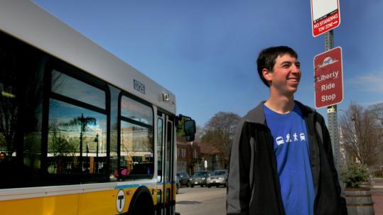
Danny Moraff (above), a 17-year-old member of Lexington's transit advisory board, has been a transportation buff for a long time. When he was in preschool, Moraff dressed as the D-Line for Halloween (below).

Danny Moraff dressed as the D-Line for Halloween.

(Source: Boston Globe via Bernie Wagenglast)

The town of Lexington’s transit service is fairly informal. The stops are pretty much wherever you happen to be standing when you see a bus.

But in one regard, the scrappy Lexpress and its six bus routes are ahead of the MBTA and its sophisticated network of boat, bus, light rail, heavy rail, commuter rail, bus rapid transit, and trackless trolley service.

Thanks to a local teenager, it was one of the smallest of pioneer transit agencies to integrate its route maps and schedules into Google Transit, a feature of Google Maps that reminds users seeking driving directions that they can also take buses and trains. Google Transit, launched in its current form in fall 2007, also helps users figure out how much time they’ll need for their trip and where and when to show up for a bus or subway so they don’t get left behind.

Danny Moraff, now 17, decided when he was 15 that he liked the idea of Google Transit – then in a developmental stage on the Web – and its ability to draw more people out of their cars. So he joined Lexington’s transit advisory board, convinced officials it was a worthwhile project, and volunteered to do all the legwork himself.

“I’m not a techie,” said Gail Wagner, transportation services coordinator for Lexpress, which has a $450,000 annual budget. “This is a shoestring operation.”

For Moraff, that meant spending all his free time riding six bus routes to plot the longitude, latitude, and typical arrival times on every block in the system. It meant logging every intersection in town and figuring out the computer coding that suited Google’s engineering needs. Moraff estimates it took him 60 to 100 hours over a period of 18 months, in between internships and schoolwork.

Click here toread the entire story.